Laurel Highlands Hiking Trail
Jump to navigation
Jump to search
| Laurel Highlands Hiking Trail | |
|---|---|
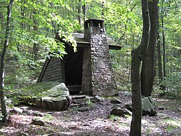
 A shelter on the LHHT | |
| Length | 112.6 km (70 mi) |
| Location | Ohiopyle, PA, USA |
| Trailheads | Ohiopyle State Park - 0 mi. PA Route 653 - 18.8 mi. PA Route 31 - 30.6 mi. US Route 30 - 45.8 mi. PA Route 271 - 56.9 mi. PA Route 56 - 70 mi.[1] |
| Elevation | |
| Elevation gain/loss | ? |
| Highest point | Mile 27 - 2,961 feet (900 m) [2] |
| Lowest point | ? |
| Hiking details | |
| Season | ? |
| Months | ? |
| Website | ? |
| Direction | ? |
| Trail agency | ? |
| Abbreviated name | LHHT[3] |
| This article is a stub. You can help the community by expanding it. |
Contents
Overview
Length:
Standard direction(s) of travel:
Season:
Trail Association: